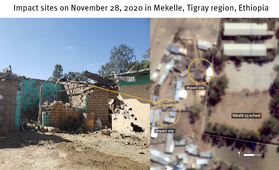
Photograph on the left shows damage to two buildings corresponding with damage visible from the satellite imagery shown on the right. Photograph ©️ 2020 Private. Satellite imagery recorded on November 29 shows at least two distinct impact sites and reveals several damaged buildings and walls to a residential compound in Mekelle, Tigray region. Damage analysis by Human Rights Watch; ©️ Satellite image courtesy of Planet Labs Inc. 2021