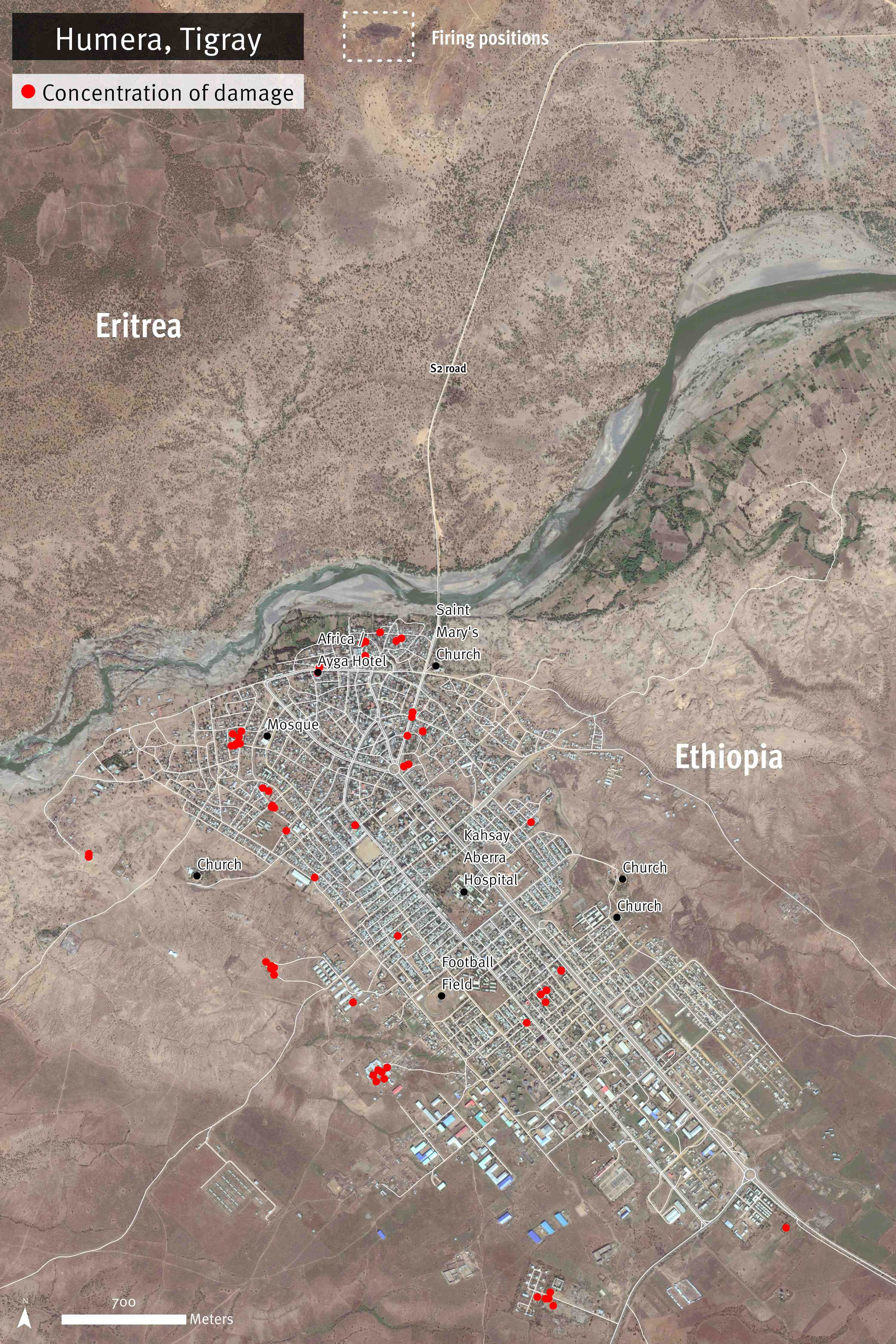
Satellite image recorded on November 10, 2020 shows buildings and streets damaged in Humera town, Tigray region, Ethiopia. The main concentrations of damage are evident on the area south of the primary S2 road. Additional damage is observed on streets northeast of Africa/Ayga Hotel, and a concentration of damaged buildings near Saint Mary’s Church. Warehouses located on the outskirts of the town and other type of structures show severely damaged roofs. The damages reported are most likely an underestimate. Damage analysis by Human Rights Watch; satellite image courtesy of Planet Labs Inc. 2021.